Brochure Update
We apologize for the delay, but the brochure has now been posted, and registration is now open!What the race is about
The Maumee Valley Tri-Adventure race is a 50-mile race run in northwest Ohio. It starts with a 36-mile biking course, followed by 6 miles of canoeing or kayaking, and ending with an 8-mile backpacking. It is the primary fundraiser for The Naturalist Scouts, a group for boys 11-15 who are very enthusiastic about the great outdoors and want to find some real adventure.
Classes
Most people do this event with a partner. There are seven classes this year
- Youth & Adult — Someone 15 or younger with someone 18 or older
- Young Adult — A team of 2 in which both members are between 16 & 24
- Adult & Adult — Two people 25 or older, or someone 16 or older with someone 25 or older
- Senior — Two people 60 or older
- Solo — Anyone one person 18 or older
- Relay — Make up a team however you wish. The canoeing event requires one person to be at least 18 years of age. The other events require participants to be 16 or older.
- Senior Solo — For those 60 and older
Awards are given to the best male team, the best female team, and the best male-female team in each class as long as they have another team to compete against, and finish with a time under 6 hours.
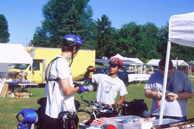
Starting
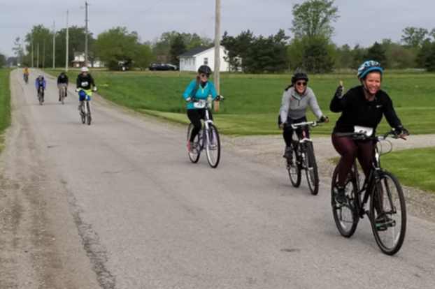
We have everyone do the 36 miles of road biking first. Each team will be given a map just as they start biking. We have also painted green arrows on the road to mark the route. There will be 2 check points where someone will write down your number as you pass. Make sure your number is visible and call it out. This will prove that you did not take any shortcuts. Men will be directing traffic in front of the Florida Library and at the Florida Bridge to improve safety. There will be water at both bicycle checkpoints, at Gessner Park, and at 2 points on the backpacking trail. We suggest using a road bike because the entire route is on paved roads (see the map). Most of the roads have very light traffic. We require that you wear a helmet at all times for safety. We also require gloves, which protect your hands in the event of a fall. The biking leg takes most people about 2 hours.
Transition #1
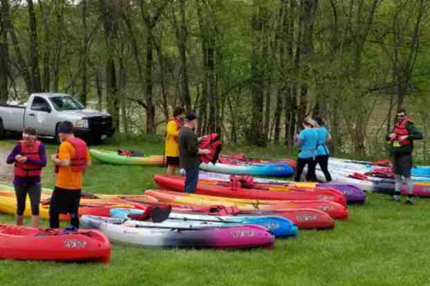
When you return from the biking, check in at the timekeepers tent. You may wish to pick up some free food and drink at our food table, but their are no time outs for eating. You should lock your bike in your vehicle or chain it to a tree. We have only had one bike stolen, and we don't want to tempt fate. You should go to your canoe or kayak as soon as possible. You may put your vessel out on the lawn before you start biking if you wish. If you are renting a vessel it will be waiting for you. Life jackets and paddles come with rental boats.
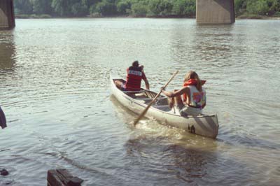
Canoeing or kayaking
We will use the Maumee River if at all possible. If the river is in flood stage we will move
the water leg to the Defiance Reservoir. If this happens we will provide maps to the Defiance
Reservoir, and the water leg may be done first or last. It is impossible to use the canal because
it is full of dead trees. The river put in point is a flat grassy area about 200 yards east of the dam.
You may place your boat at the grassy area when you arrive in the morning. Be sure to put your
name and team # on the bow of the boat. If you rented a canoe or kayak it will be there waiting
for you. Most people require 2 hours for the water leg, but experts can do it in 1 hour. If a flood
forces us to use the reservoir, everyone will be required to make 5 laps, which is 6 miles. Life
jackets and shoes are required. If anyone requires canoe training, they should call Larry Lindsay
at
Transition #2
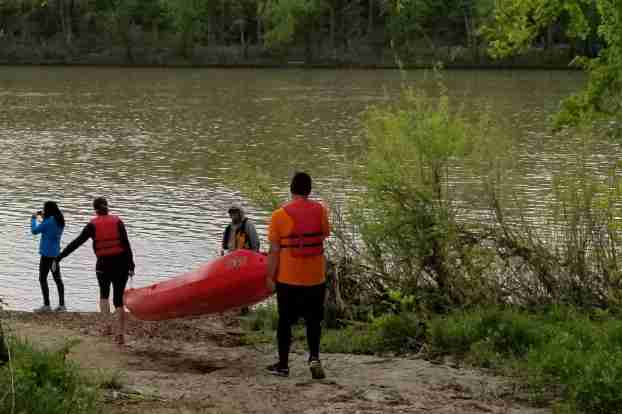
You will know you are finished canoeing when you reach the first bridge that crosses
the Maumee River and the canal. At this point, you must stop and take your canoe
or kayak out on the left bank just before the bridge. Then you must carry your canoe
up the small hill and slide it into the old canal. From this point it is only about
a quarter mile east to the finish point at Gessner Park in the village of Florida.
There will be a timekeeper in Gessner Park to write down your time of arrival. You
should leave your canoe or kayak at Gessner Park. We will have people watching them,
but you may chain it to a tree if you wish. Rental boats will be picked up.
Backpacking
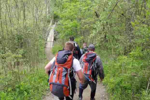
There is no time out during transition. It is important not to waste time as you move from the canoeing leg to the backpacking leg. Your backpack must be 20% of your body weight. You may drop off your pack anytime after 6:30 a.m. at Gessner Park. Another option is to get your backpack weighed at the marina parking lot at the Independence Dam Marina Parking Lot, and we will truck it to Gessner Park for you.
Hiking
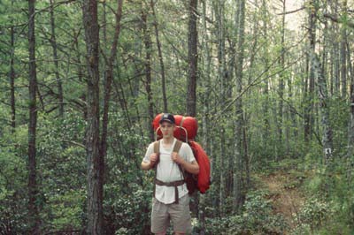
The backpacking leg is 8 miles. You start at Gessner Park and hike uphill for 1 mile. Then you will pass a checkpoint, cross a bridge over a waterfall, and head west on the towpath trail. The towpath trail is a beautiful 5 mile hike with the river on your left and the old canal on your right. The trail is a tunnel of trees, and there are many spring wildflowers. The last 2 miles passes through picnic areas in Independence Dam State Park. The hike ends at the Marina Parking Lot where you began the event. See the hiking map here
Finish
When you finish the hiking, you must check in with the timekeepers. They will give you your final times. We will post the times on this web site as well on the results page. The awards will be mailed in mid-June.
Additional Information
Brochures are available at most northwest Ohio, southeastern Michigan, and northeastern Indiana bike shops and health clubs. You may also call 419-806-2328, or email race@maumeetriadventurerace.net YOU MUST MAIL IN YOUR ENTRY FORM OR WAIVER WITH YOUR SIGNAURE ON IT. You can find the full entry form here. Alternatively, you only need to send in the waiver by registering on this site. Mail your application (or waver) and check or money order to:
The Naturalist ScoutsPO Box 36
Swanton, Ohio 43558
Credit cards are not accepted on the race day.